Sunday, October 28, 2012

Chair Peak Basin, Snoqualmie Pass, August 2nd, 2012


The Great Scott Bowl, and The Tooth, from the trail.

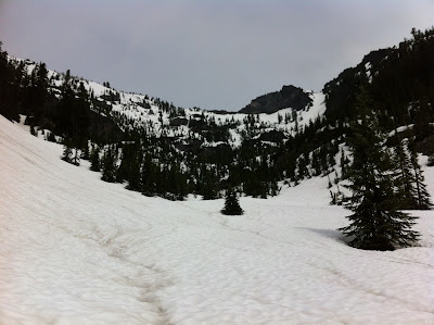
Looking down-valley from the final approach into the basin.

The view from the basin looking east to Mt Snoqualmie and the Cascade Crest peaks beyond.

Looking up into the basin from the rim. The east face of Chair Peak dominates the head of the basin.

 A triptych...
 ...of the rubble-
laden snow in the upper basin.

The basin after lunch, and turns. While I was sitting on the ledge at my high spot below the east face eating my lunch, a woman in her early sixties climbed up and joined me. I noticed she was wearing a 'Little House on the Prairie" bonnet under a bicycling helmet. She asked if I had ever climbed Chair Peak. I responded that I had, a few times. Not having climbed this peak, she asked for advice about the Northeast Buttress route. I told her what I knew as she munched on her sandwich. After she was done, she thanked me and struck out up the ledges to the base of the route. After I took this picture, I looked for her and finally found her making her way up the lower third of the rock buttress that can be seen just left of the dark part of the peak on the right. During our time together I asked her if she had climbed anything else in the area. Her response was, "Most of it."

 The Tooth and Great Scott Bowl from the same spot as the last image.

A panorama of the ridge from Chair Peak to the Tooth.

Saturday, October 20, 2012

Mt. Rainier, Summerland, July 6-8, 2012


Me.

  
Phil at the Bridge


Brian and the Big R.


 The view expands as we near the lower slopes of Summerland.

 
 Brian and Phil climbing into lower Summerland.


Lower Summerland

Our camp in the "Meadow".  Both afternoons, we were approached by rangers who informed us that we were illegally camped in a meadow. They were nice enough to not cite us and make us move, but now we are in "the system".


 After setting up our camp we skied up toward Goat Cirque and upper Summerland in search of running water, and turns.

Climbing above the valley bottom gave us this view of Goat Cirque.

 
Phil, ripping some turns on the way back toward camp.

Our morning view from camp.

 
 After breakfast, we skinned up to the watering hole before heading up toward Panhandle Gap.


 Brian and Phil skinning toward Panhandle Gap. Meany Crest, with Rainier behind, is in the background.


Panhandle Gap is the corniced saddle right of center.


The view to the northwest from above Panhandle Gap

 
The view to the south from the Gap.  Goat Rocks is on the left, and Mt Adams is the big one to the right.

 
 Phil, skiing the slope above Panhandle Gap.


Phil taking a picture of Brian skiing down. The cornices on Panhandle Gap loom above.

Brian, skiing down slopes below the Gap.

 
Me, skiing into Goat Cirque (photo courtesy of Phil).

Phil, climbing into Goat Cirque for one more run before heading back to camp.


Sunday, July 22, 2012

Klahanne Ridge, Olympic National Park, June 12th, 2012

 Climbing the route of the snow-covered Switchback Trail. We would return to the car down these slopes.
Approaching the ridge top.

 Looking south toward Hurricane Ridge and the heart of the Olympic Range beyond.

 From the top of the ridge, looking down into the north bowl.

 Kevin making tracks down the upper bowl. The snow was new from the last couple of days, buttery smooth, and very fast.

 We met a local named Gary at the top of the ridge. He caught up with us at the bottom of the lower bowl.

 Heading back up...

 and up..
 and up.

The view out over the Strait of Juan de Fuca, to Mt. Baker, from the top of the ridge.

Monday, June 18, 2012

Lundin Couloir, June 3, 2012


A rather ugly start to a rather unpleasant tour.

Majestic old fir at the rim of Commonwealth Basin.
Commonwealth Creek, at the entrance to Commonwealth Basin
My objective was the snow couloir in the upper right of this picture. A grove of subalpine fir blocks the entrance to the start of the couloir.
Avalanche debris at the base of the Lundin Couloir. There was a grove of subalpine firs filling the entrance to the middle third of the couloir. I named it The Strainer. It was steep and the firs created a snaggle-toothed environment that couldn't be bypassed.
Looking up at the final climb to the col at the top. Unfortunately, this was my high point.
Looking down on the middle third of the couloir from my high point. (You can see The Strainer in the middle of the picture.) I stopped here to eat some food and hydrate. Within minutes, a squall blew through, making everything wet. I was figuring to wait this out and get to the top of the route, but then the thunder starts rolling in. Time to go down.

Monday, May 28, 2012


I found a crack in the toe piece of one pair of my Switchback binding. I sent this picture to Voile on a Monday, and by Friday I had a new set of beefier toe pieces, under warranty!
Voile rocks!